
Know the Ground.
Own the Hunt.
A precision mapping tool for the backcountry. Bare-earth LiDAR. Line-of-sight viewshed. Hunting-unit and public-land overlays. Terrain you walk in 3D before the season opens, online or off.
See the terrain, not the trees.
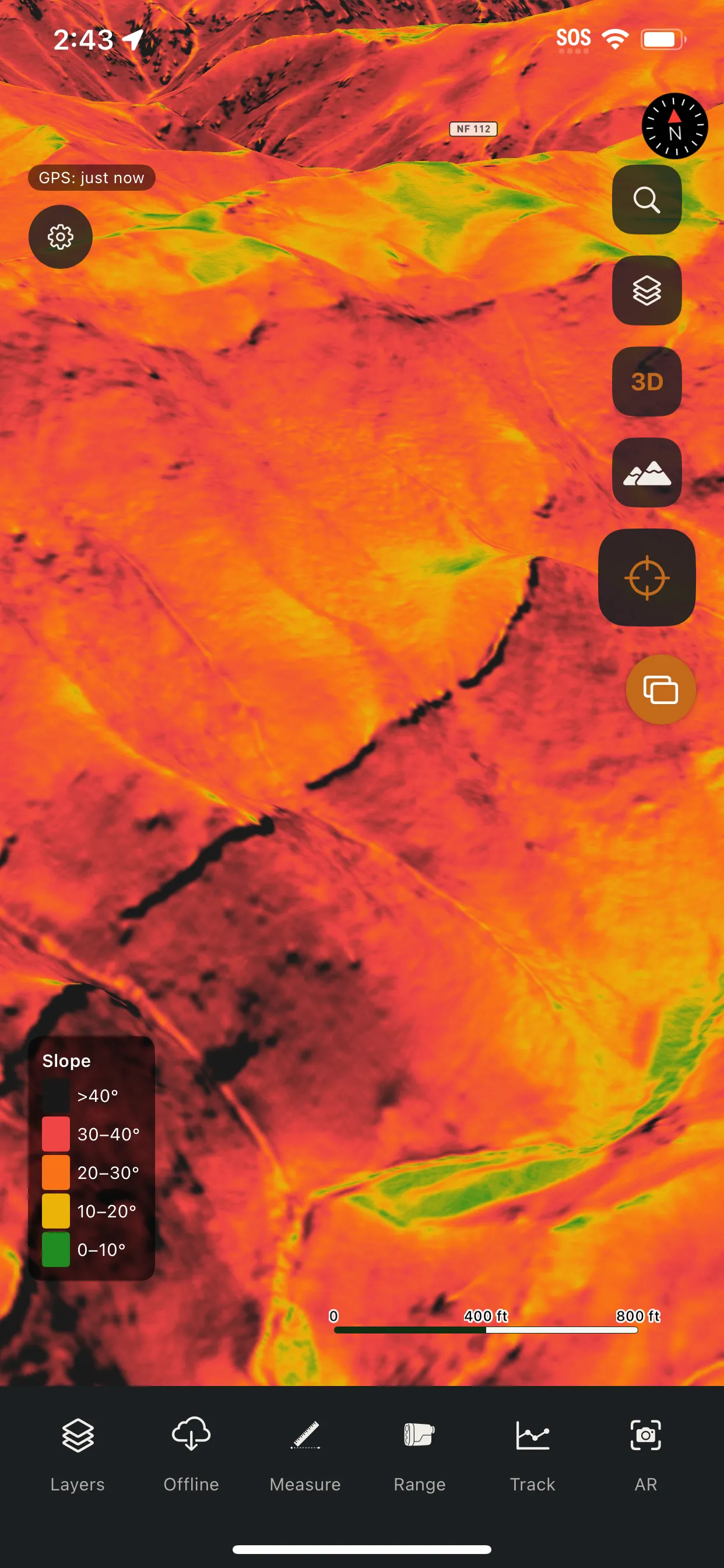
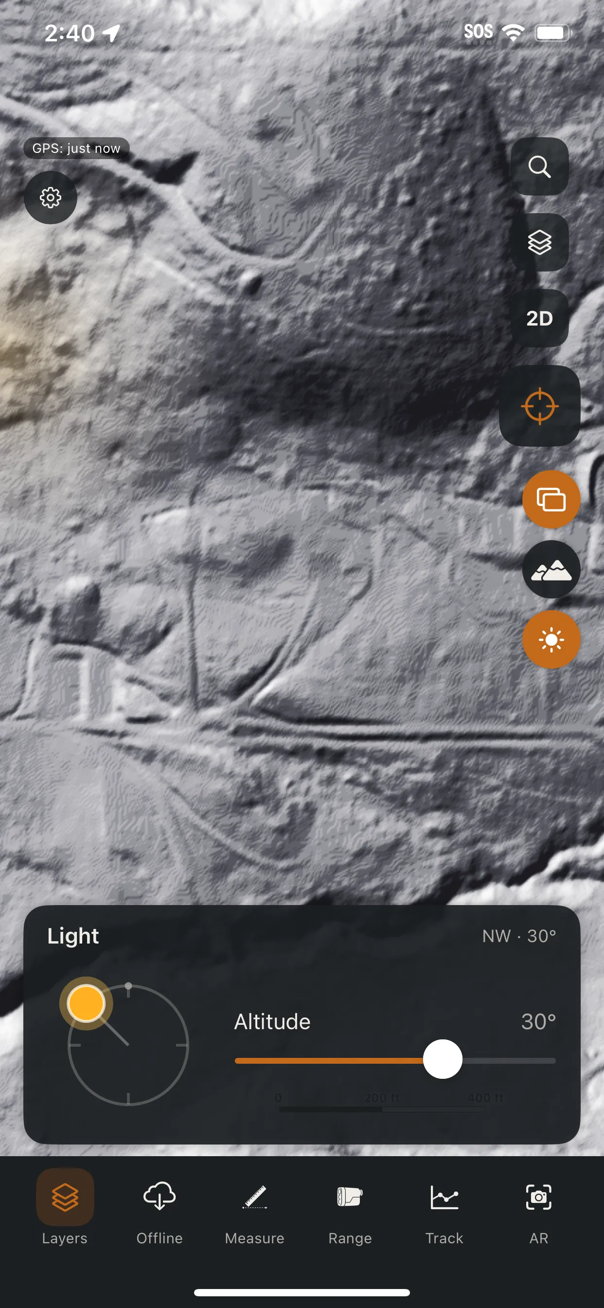
A high-resolution LiDAR engine renders the true shape of the ground on your device, resolved to roughly 3 ft. It surfaces the micro-terrain that satellite imagery buries under canopy and other maps flatten away.
- Slope shading: spot benches, saddles, and bedding terrain at a glance
- Hillshade & low-angle light: reveal subtle ridges and drainages
- Sun & shadow modeling: see where light falls at any date and time
- Local relief mapping: pull out terrain other maps smooth away
Know what you can see before you climb.
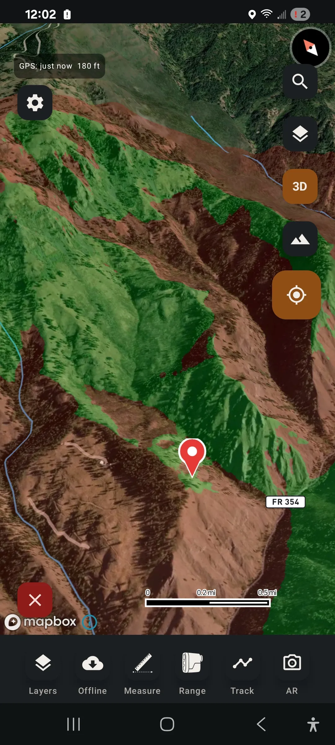
Drop a pin on a glassing knob, a stand, or camp. Talus maps exactly what's in view out to roughly two miles. Green is visible, red is blocked. Find your glassing points from the truck, not after the climb.
Peaks and pins, on the live view.
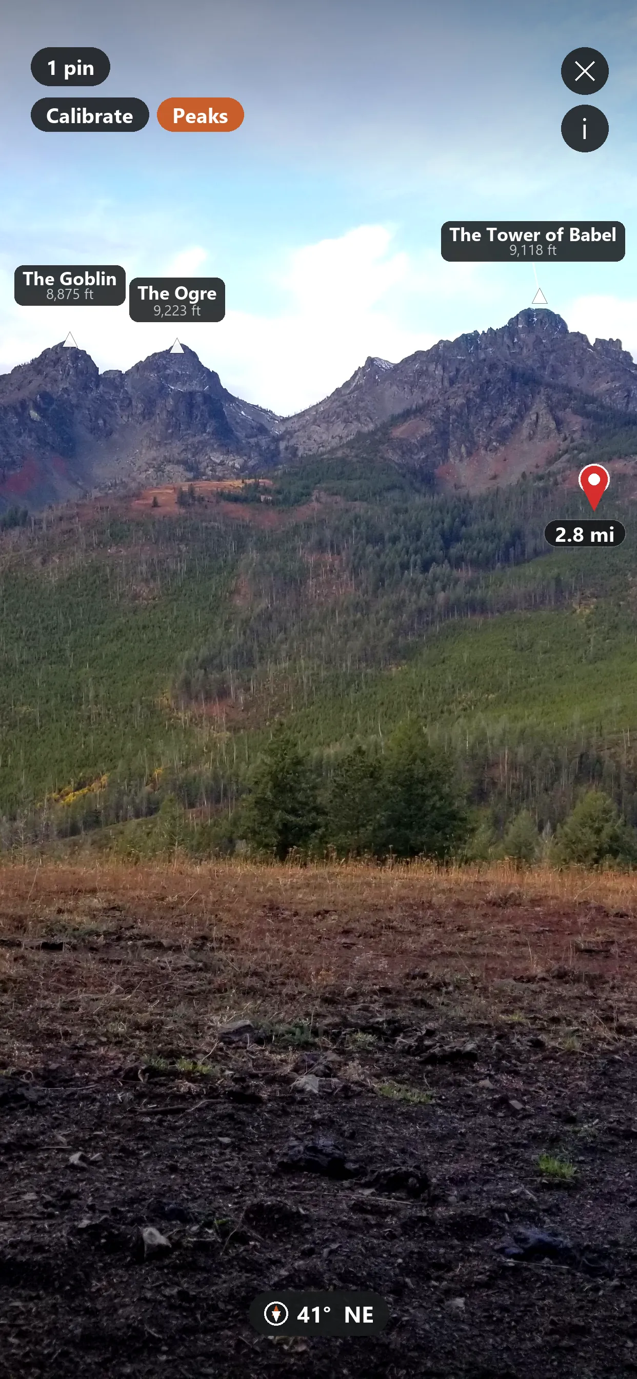
Raise your phone. Talus labels the peaks around you and your saved pins on the live camera view, each tagged with true bearing and distance. The ridge, the stand, and the spring, exactly where you look.
Scout the country from your couch.
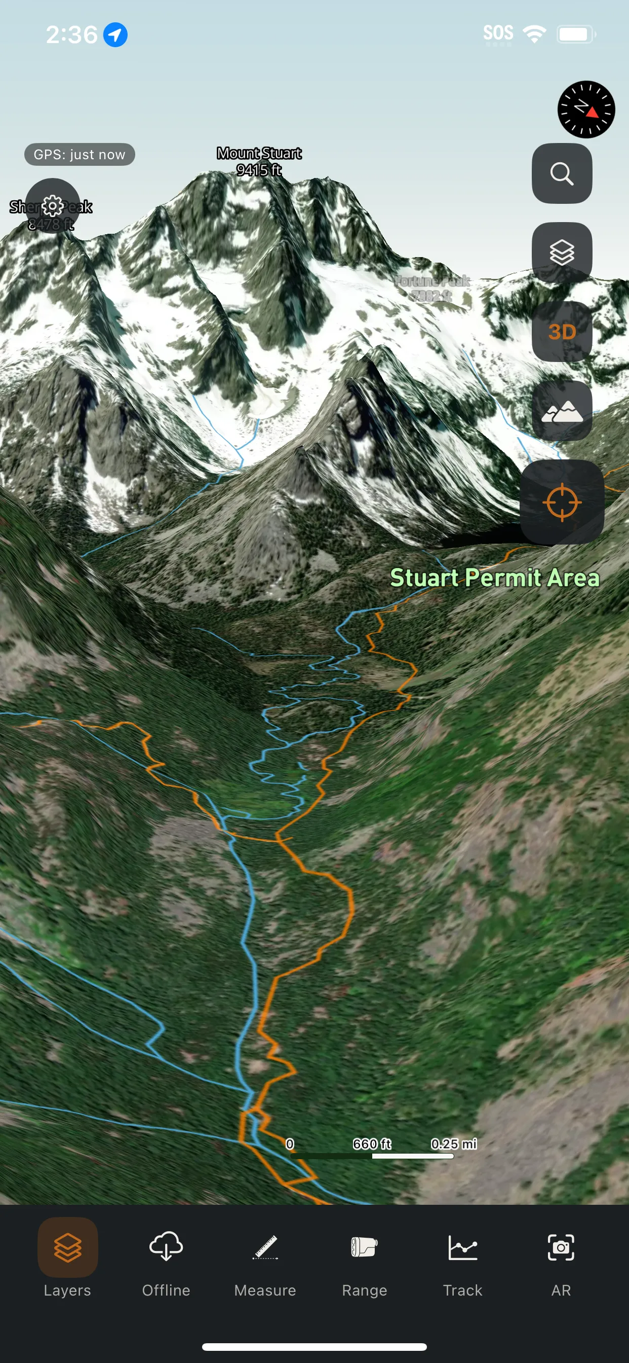
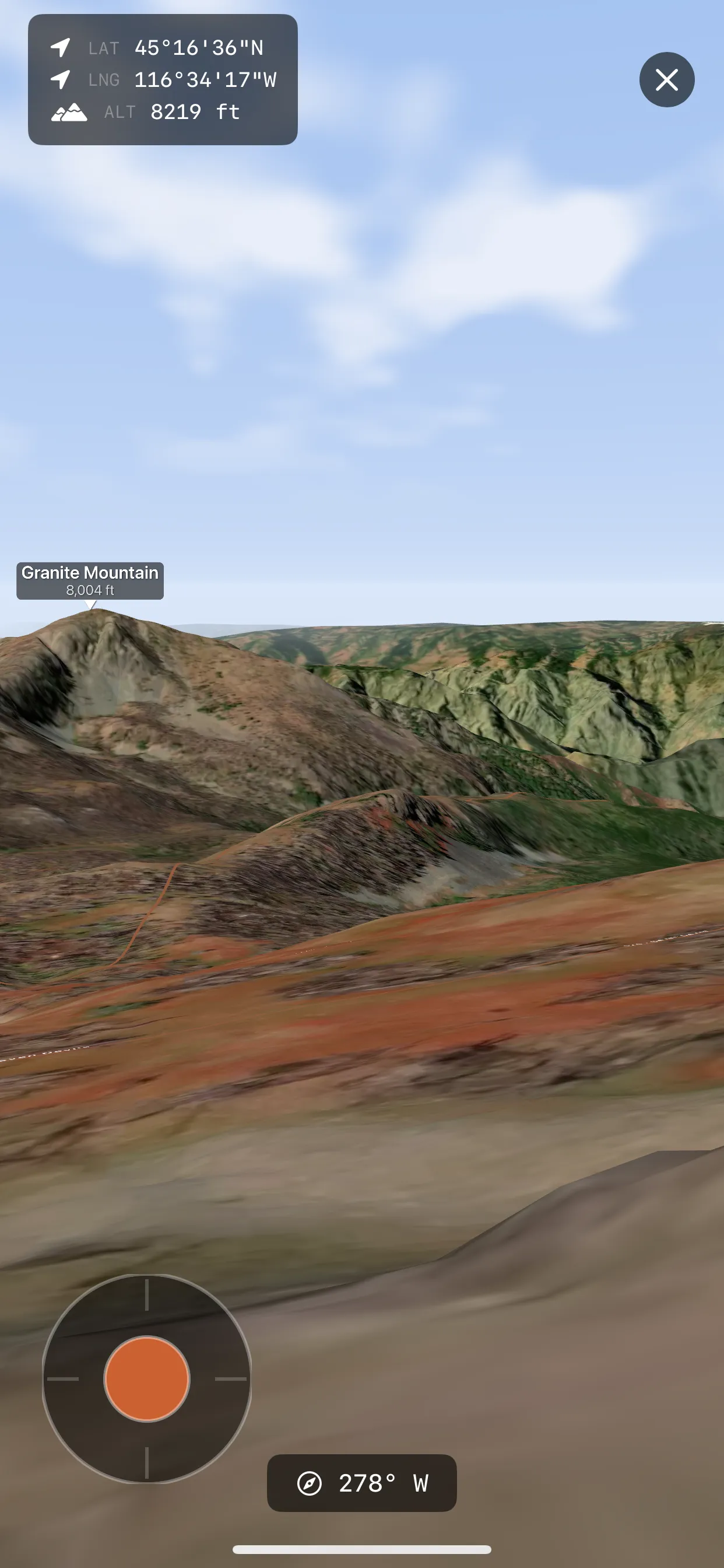
Drop into the landscape in first-person 3D. Real elevation, draped in satellite imagery, with trails and named peaks in place. Walk the ridgeline and check what's over the saddle before opening morning arrives.
Every boundary that matters.
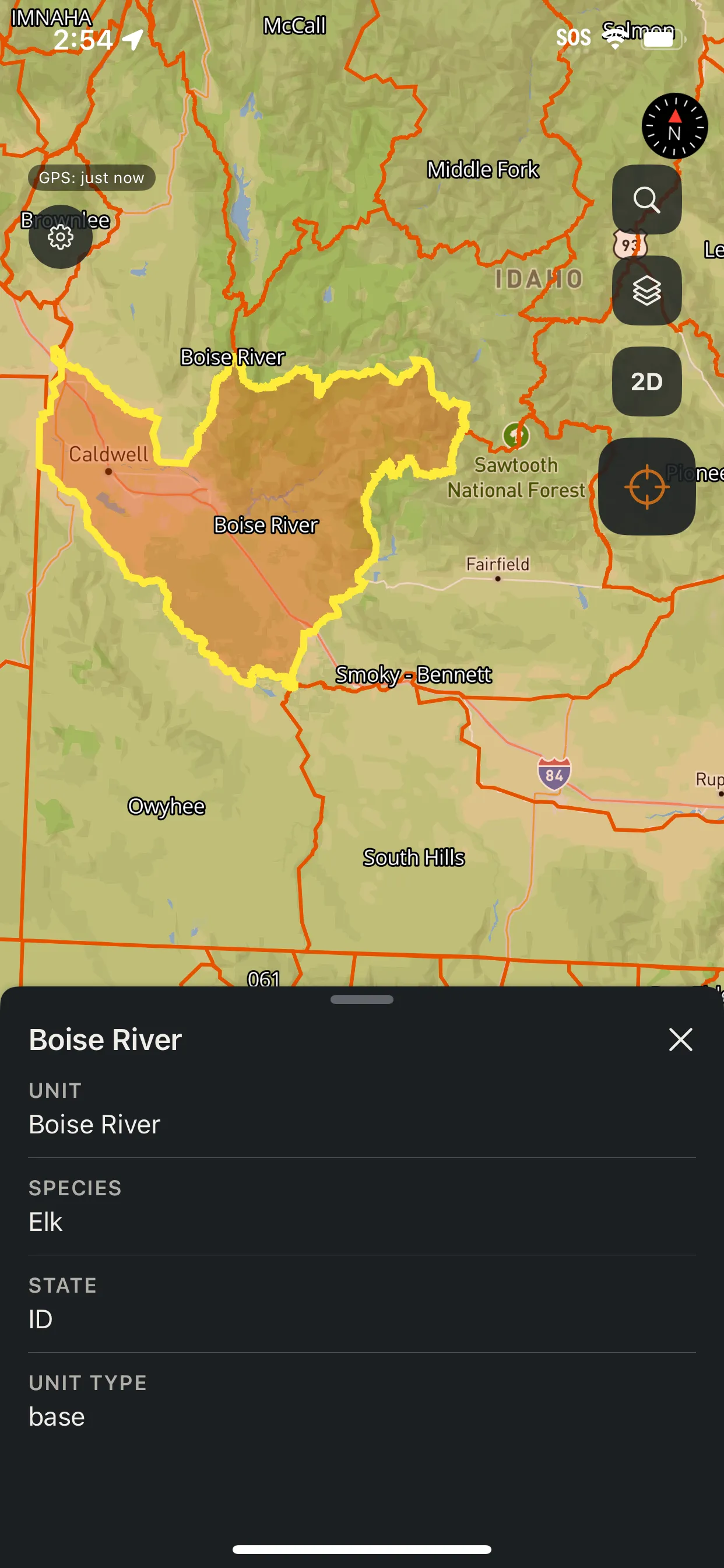
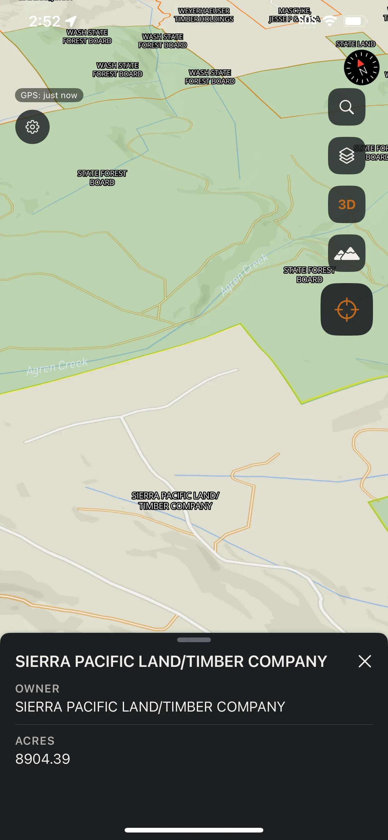
Hunting units filtered by species and state. Public land and private parcels with landowner names, so you know whose ground you're on. Water, trails, contours, and current and historical wildfire perimeters. Tap any feature for the details.
The layers a serious hunt runs on.
Hunting units, public-land and parcel boundaries, water, trails and roads, contours, wildfire perimeters, and place names, assembled from authoritative sources and tuned for the field.
Sources: named places · public lands · county parcels · state hunting units · hydrography · wildfire perimeters · LiDAR-derived terrain
Free to start. Talus Pro when you're serious.
Read the terrain on free base maps and contours. Unlock pins, tracks, offline maps, and the full hunting-overlay set when the hunt demands it.
Free
$0
- Interactive topo & satellite maps
- Contour lines
- 2D & 3D map view
- Cross-platform sync
Talus Pro
Pricing at launch
- Pins, tracks, routing & measuring
- AR overlay & first-person 3D terrain
- LiDAR visualizations & viewshed
- Hunting units, public land & overlays
- Offline map downloads & place search

Be on the mountain first.
Talus is in final field testing on iOS and Android.
Before you head out.
When does Talus launch?
We're in final field testing on iOS and Android, ahead of launch on both platforms.
Will it work with no signal?
Yes. Download any area before you go. Base maps, overlays, and LiDAR terrain come with it, and place search runs against an on-device database. Slope, shadows, viewshed, and 3D all keep working offline.
What's free, and what's in Talus Pro?
Base maps, contours, the 2D/3D map view, and cross-platform sync are free. Talus Pro unlocks pins, tracks, routing, measuring, AR, first-person 3D, LiDAR visualizations, viewshed, hunting-unit and public-land overlays, offline downloads, and offline place search.